
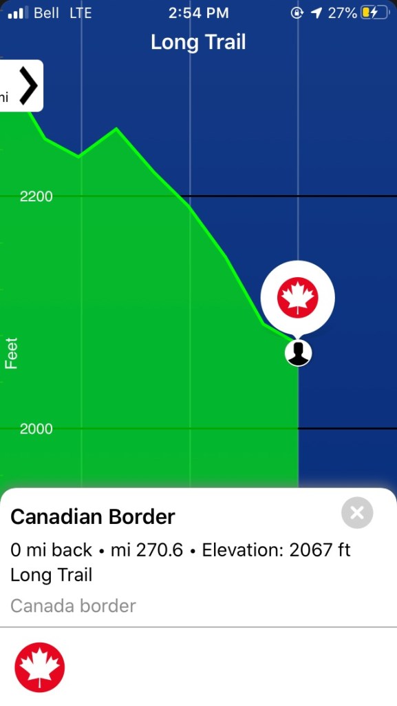
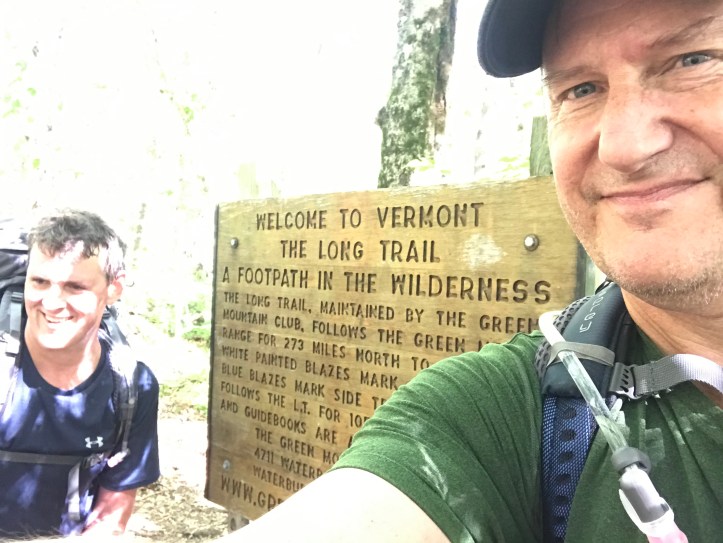
Miles: 12.4; Elevation gained: 3,410 ft; Mile reached: 270.7 (+ 1.3 to pickup point!)
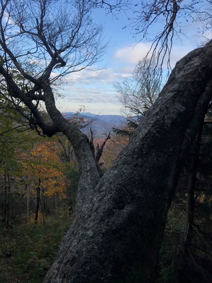
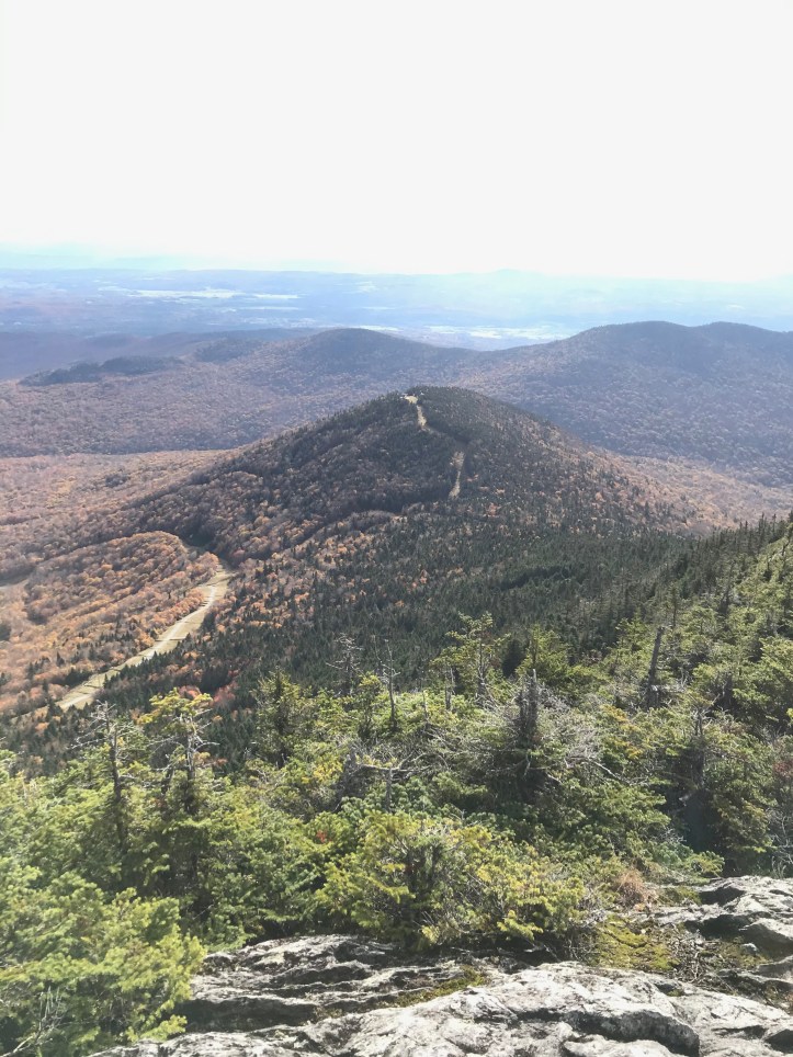
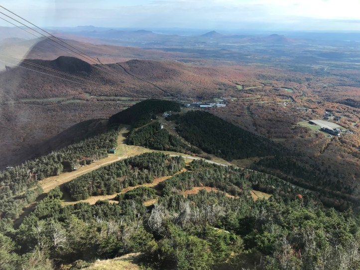
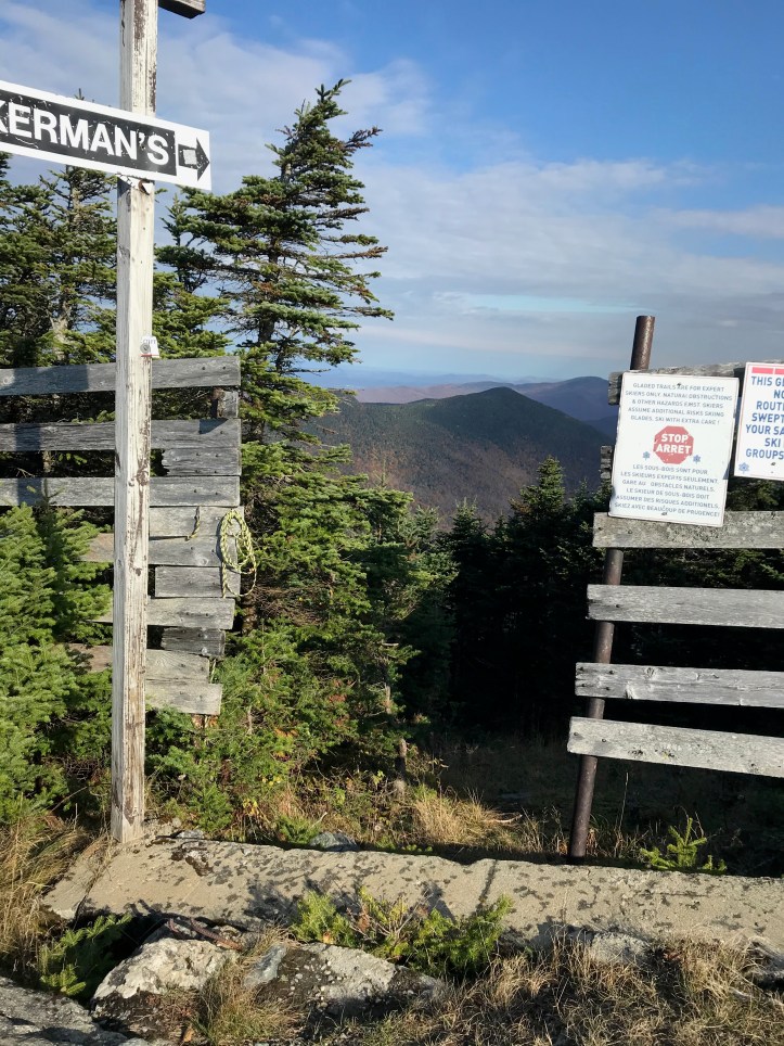
Jay Peak is a great mountain to summit, as long as you don’t mind the heavy presence of man in the form of ski trails, snowmaking infrastructure, and a lodge/tram station at the very top. As a skier, I certainly don’t mind – or at least shouldn’t – and the trails cut down the mountain give a hikers a great way to have wide open views well before the top. But I wouldn’t want them on every climb, for sure. On Camel’s Hump, there is nothing, which I’m sure is one of the reasons it’s such a popular day hike, and there is nothing on Abraham either. Mansfield of course has not only the ski area but also the chunky array of comm towers on the Nose, which would in fact be a great spot to hike to except that you are not allowed on it. There is an 1858 painting by Jerome Thompson, “The Belated Party on Mansfield Mountain,” that hangs in the American Wing of the Met in NY. It shows a party of 6, with 3 of them looking NW towards Lake Champlain and the Adirondacks, with the Chin taking up most of the right side of the frame. It’s a view you can’t get now, as I am almost positive these folks are sitting on the Nose. Anyway, that’s obviously the title image here of our last day – my corny ode to all who came before us.
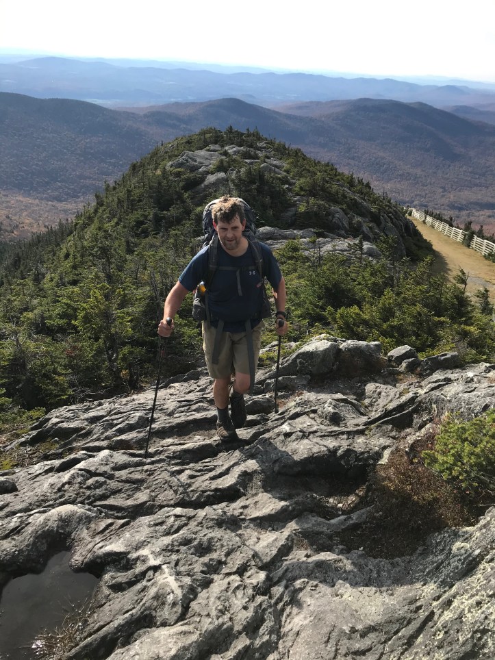
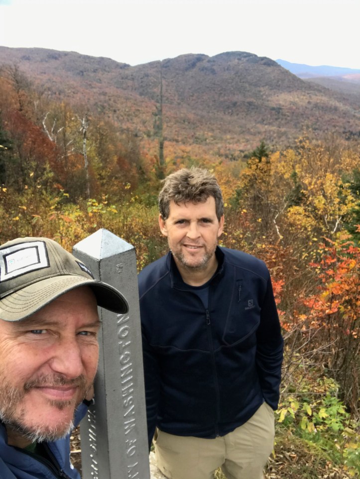
In any case, the ascent on the south side of Jay is pretty mellow by northern LT standards, and after only about 0.7 mi, you can access the ski trails with views to the north and east, after which the trail goes up the only real steep pitch, then crosses another trail near the summit to put you on a rocky climb above tree line to the lodge. The north side is a different ball game – darker, wetter, steeper once you reenter the woods. After Jay, the LT does not exactly turn into a pool table surface to bid you farewell – in fact, there is still another roughly 1,800 feet of elevation in the form of Doll Peak, Burnt Mountain, and Carleton, the last of which comes only about 1.5 mi from the border. All the while you have the END firmly in mind and you just want to get there! Just to keep things interesting, and because Marcia was meant to pick us up at 3:00, I tried to maintain a 2 mph pace from the base of Doll to the border, which I managed, but just on the dot. Just another indication of the difference up north: in the south, I think we were comfortably at 2.5 mph, which obviously makes a big difference over 7-8 hours of hiking. Overall we managed the 280 (I am counting the access on both ends) miles in 20 hiking days, so about 14 miles a day, and the only way we achieved that was to put in quite a few days over that mark down south, including the 19 mile day that included Stratton. That day alone allowed us a few below average days.
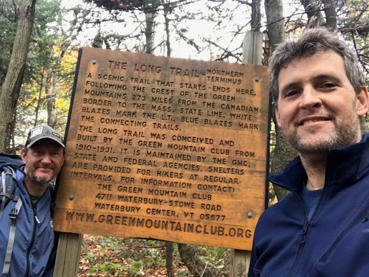
20 hiking days was the goal, and we hit the mark. Shout out to Chris M, who has not hiked nearly as much as I have, and had never done a long distance hike. There was no serious waiting time for him at all, and he was in fact quicker than me on flats and descents, as I’m ‘fraidy scared of blowing out the ankle that is still weakened from face planting on the trail in ’18. I take smaller steps going down now because it’s easier to recover from a wobbly foot fall when your back leg is closer to your front. Mortality looms a bit larger now I suppose, though God knows I hate to admit it!
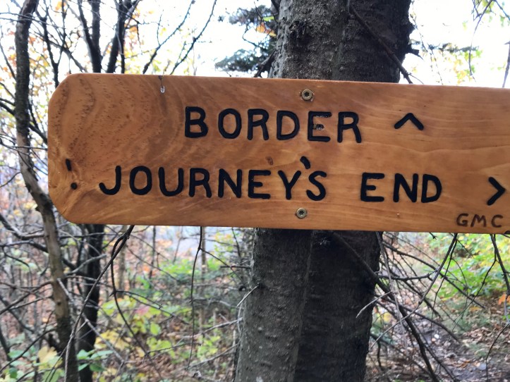
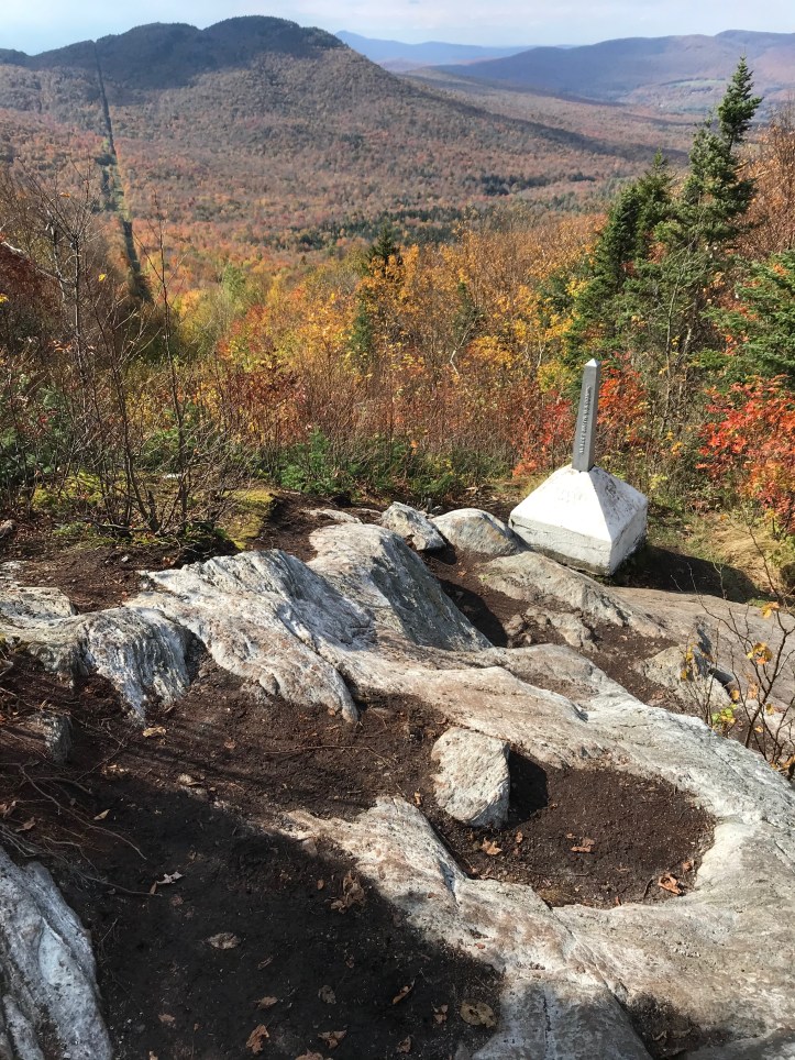
The border, as I said last year, looks like a power line cut through the forest, but with no power lines. When we were headed out to the parking lot, someone staying at Journey’s End Camp asked if there had been agents up there, and I said no and expressed a bit of incredulity that this would ever be the case, and the guy said no they are around quite a bit due to drug trafficking. I always wondered why you couldn’t just scoot from the VT woods to the other side – you’d be exposed on the border strip for 3-4 seconds max, and there are no roads or anything else there. He said there are cameras all over and that if you tried this, they’d come find you very quickly! Not that I had or have any plans to make a dash, but I remain a tad skeptical all the same. Maybe someone try it and let me know?
Almost forgot – even though our pickup time got pushed out to 4:20, Other Chris never showed. Hope he made it out safely and got south. If he stayed true to form, he was probably warming his feet at an inn fireplace by the time we hit the trailhead. We wish him well!
That’s a wrap for Day 20 and the entire trail. I am going to do one more post to summarize and to go over gear – something I haven’t really talked about in either of my end-to-ends. I don’t obsess on gear like some hikers do, but it is obviously pretty key, especially if you get out there and find you have the wrong stuff. The consequences range from inconvenient to dangerous!


Finally got to the last two posts. What a wonderful trip! What a tremendous life experience! (Times two)Congratulations!
LikeLike